Doggerland
Europe's Real Sunken Land
Beneath the grey waves of the North Sea lies the remains of a lost world. Not a myth. Not a legend. A real landmass — larger than the Netherlands and Belgium combined — that once connected Britain to Europe, teeming with forests, rivers, mammoths, and human communities.
It was drowned by rising seas and shattered by one of the largest tsunamis in geological history. Eight thousand years later, scientists are pulling its secrets from the seabed.
46,620 km²
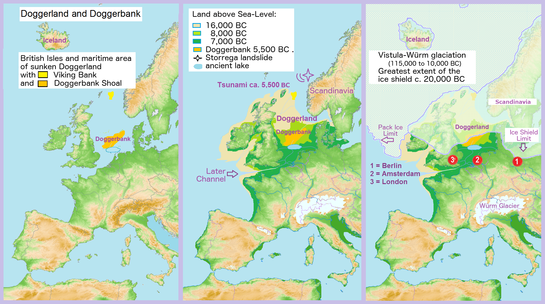
Doggerland stretched from eastern England to Denmark, the Netherlands, and northern Germany — an area larger than many modern European countries, with hills, rivers, marshes, and dense forests.
Thousands
Mesolithic hunter-gatherers lived, fished, and hunted across Doggerland for millennia — possibly Europe's most densely populated region.
25m waves
A catastrophic submarine landslide off Norway around 6,200 BCE triggered waves the height of an eight-storey building.
2,000+
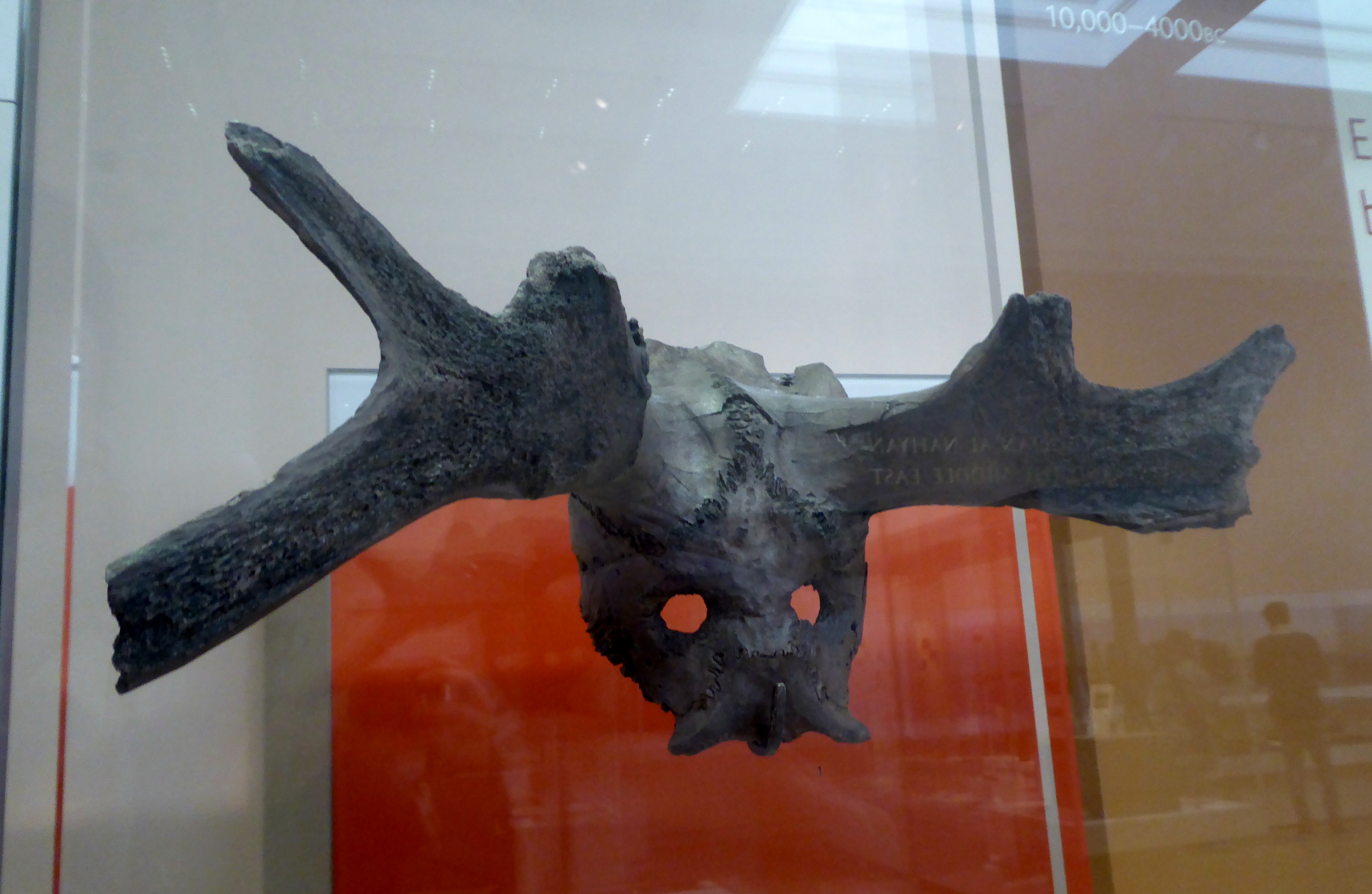
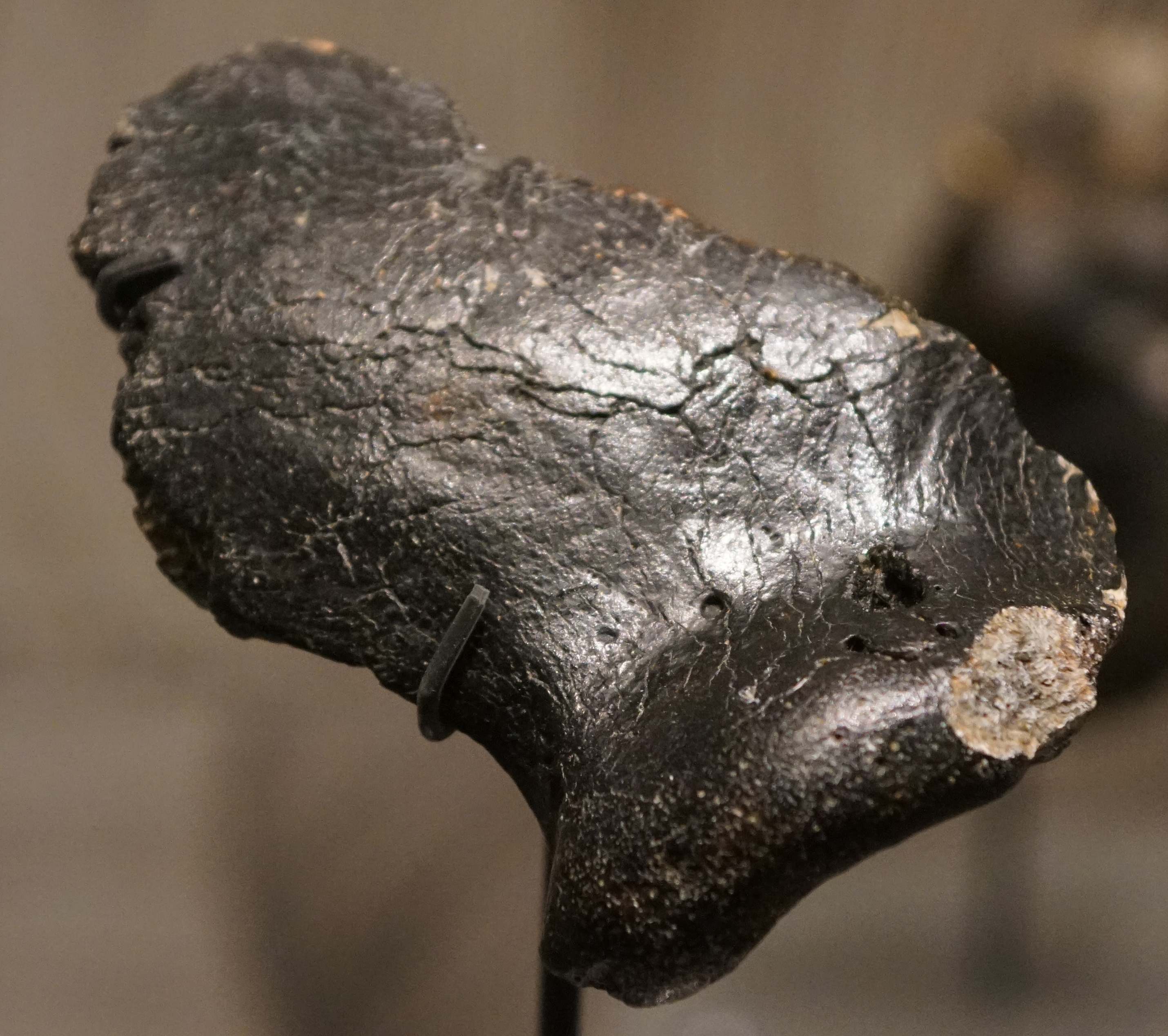
Stone tools, bone harpoons, mammoth bones, a Neanderthal skull — all hauled from the North Sea by fishing trawlers and research vessels.
The Evidence
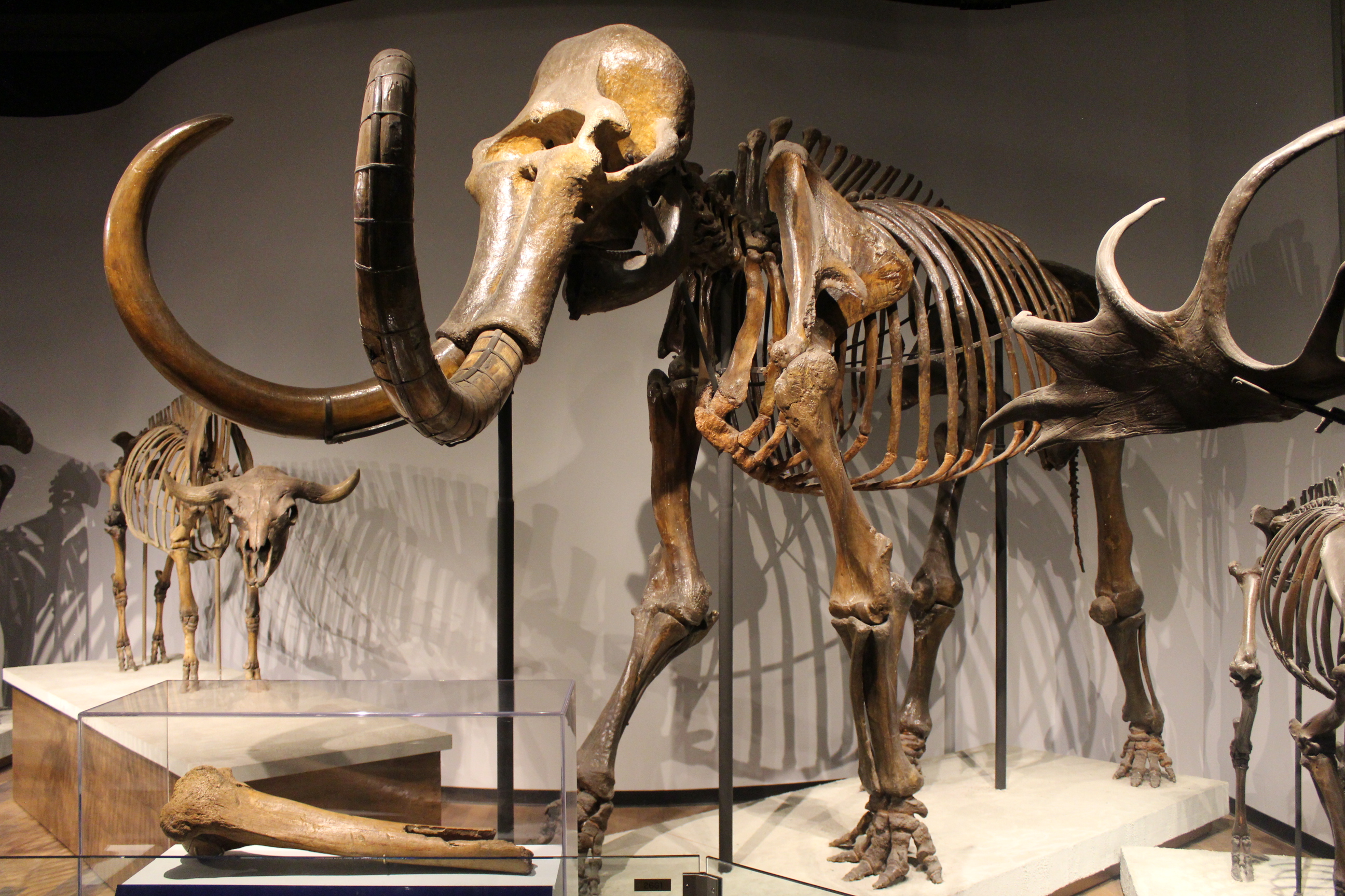
Bones from the Deep
Mammoth tusks, rhinoceros femurs, cave lion teeth — the North Sea floor is an enormous, disordered natural history museum. Fishing trawlers have been hauling up Pleistocene bones for over a century.
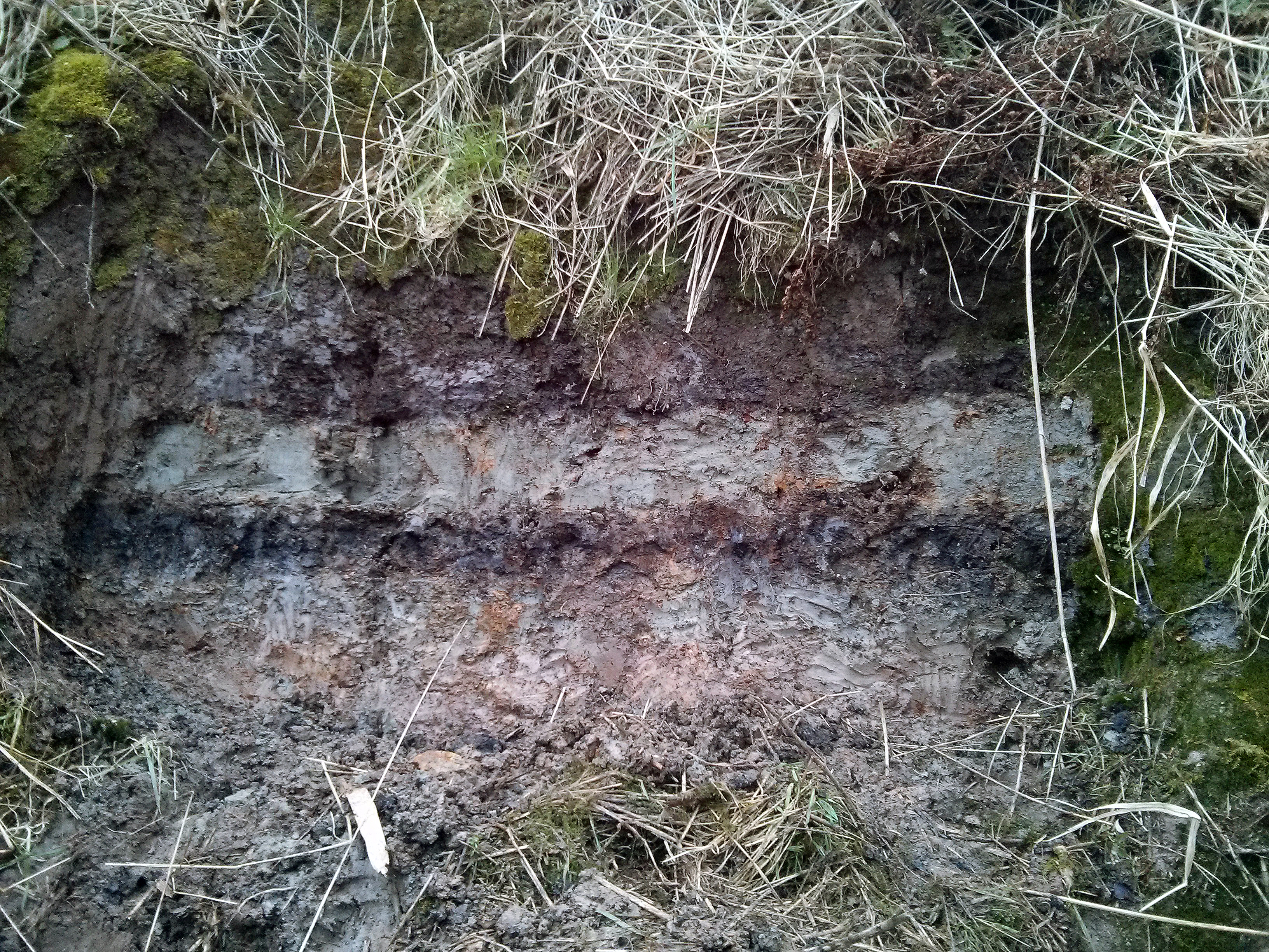
Sand in the Peat
Layers of marine sand sandwiched between terrestrial peat — the geological fingerprint of the Storegga tsunami. Found up to 80 kilometres inland in Scotland, driven there by waves that surged across the low-lying landscape.
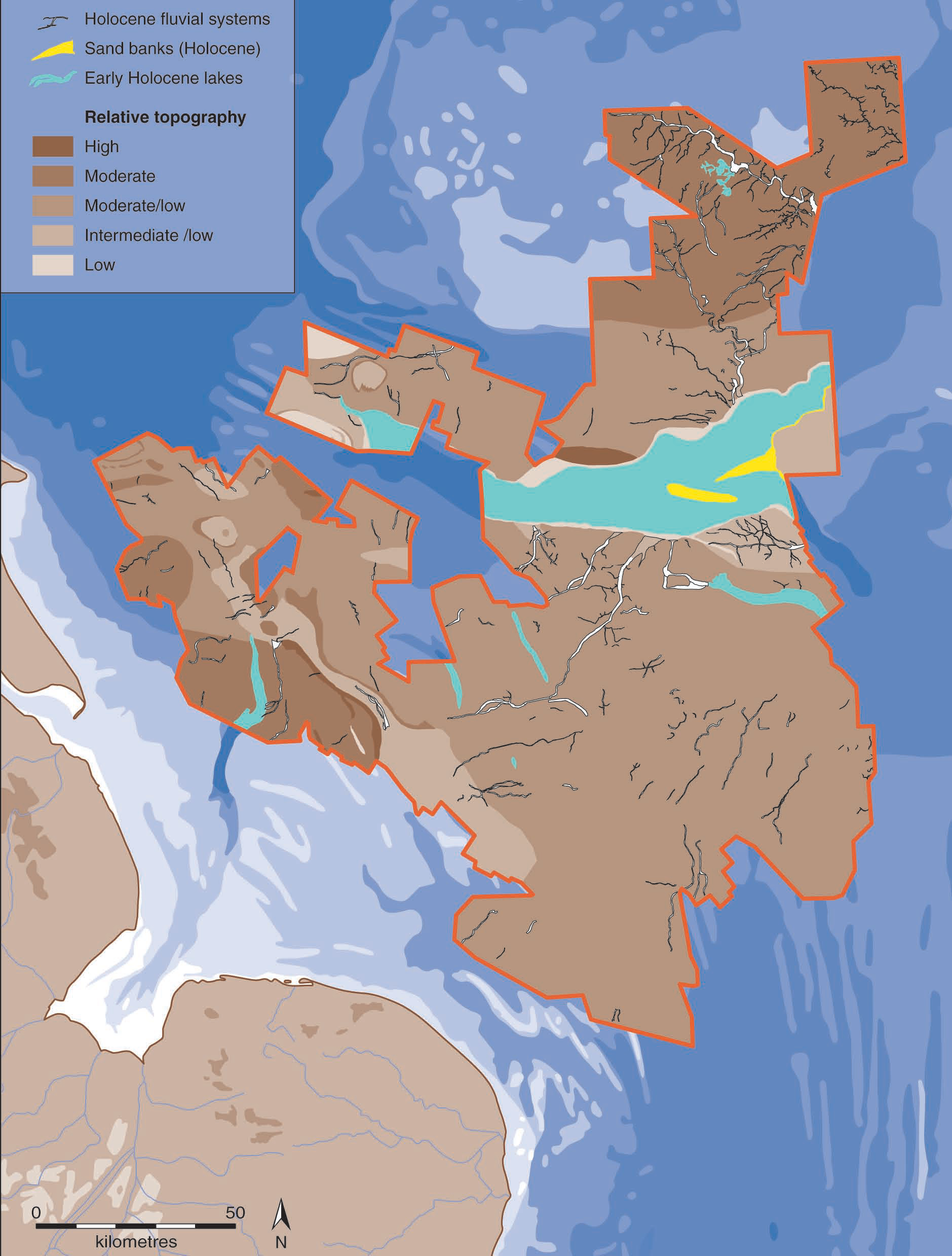
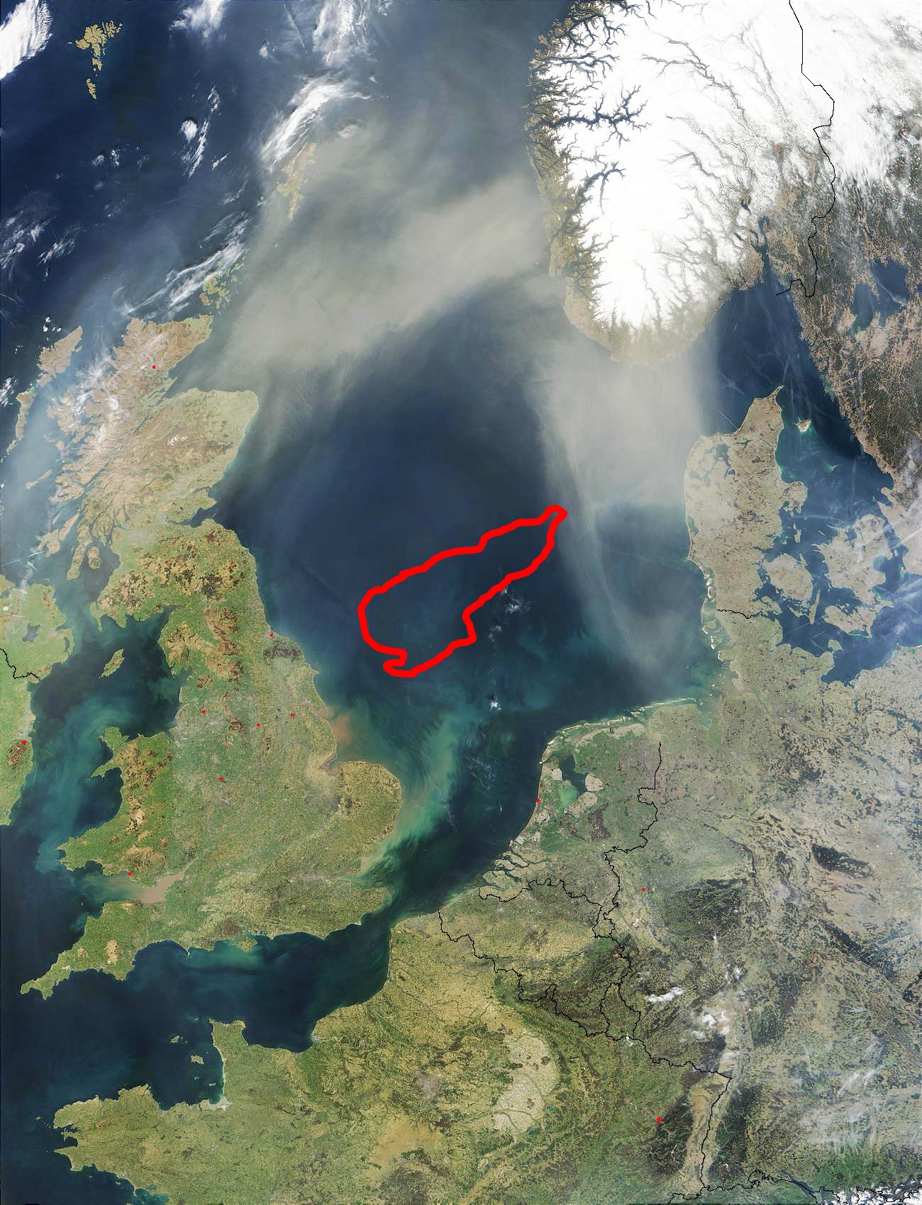
The Invisible Map
Using oil company seismic data, scientists have mapped 25,000 km² of submerged rivers, lakes, and coastlines — the topography of a world unseen for eight thousand years.
The Drowning of a World
Ice Retreats
As the Last Glacial Maximum ends, Doggerland emerges as habitable tundra — home to mammoths, woolly rhinos, and cave lions.
The Golden Age
Temperate forests cover Doggerland. Mesolithic hunter-gatherers fish its rivers, hunt its forests, and build settlements along its coastlines.
The Great Wave
The Storegga Slide — 3,500 km³ of submarine debris — triggers a massive tsunami. Waves up to 25 metres devastate the remaining Doggerland islands.
The Colinda Harpoon
A fishing trawler hauls up a barbed antler harpoon, roughly 12,000 years old, from the North Sea — the first clear evidence of human habitation on the submerged landscape.
The Pioneers
Bryony Coles
Named Doggerland, 1998Professor emeritus at the University of Exeter who published the seminal 1998 paper that gave the drowned landscape its name and reframed it as a homeland, not merely a land bridge.
Vincent Gaffney
University of BradfordLandscape archaeologist who spent two decades mapping Doggerland using oil company seismic data. Principal investigator of Europe's Lost Frontiers, the largest directed archaeological research project in Europe.
The Warning Beneath the Waves
Doggerland is not Atlantis. It is something far more unsettling — a real lost world, drowned by the same force that threatens coastlines today: rising seas driven by a warming climate.
190 million people currently live on land projected to be underwater by 2100. The story of Doggerland is not just about the past. It is a warning about the future.
Get the Full Book
10 chapters. The complete story of the land beneath the North Sea — from Ice Age megafauna to the Storegga tsunami to the scientists racing to map it before it's lost forever.
